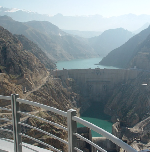
 In 2018 while on assignment in Iran, I was looking into conducting an audit of the largest dam in the country, the Karun dam, one of my comments regarding how and what I would audit, and then while explaining the measurement criteria for emergency response, I said I would have the company undergo one or two practical exercises, and that I would draft out some realistic scenarios.
The following day I asked how far the Iraq border was from the Dam, why they asked, well if I wanted to blow up this dam and cause horrific loss of life and damage, what better way than to load half a ton of explosives onto a drone, although this was simply a passing comment from my end, the conversation continued for the rest of the day.
As safety professionals, it is our job to look for new risks, and prepare a response or at least address how we could mitigate the risk. As I understood the situation, Iran and Iraq have been at war for years, therefore the unmanned flying object a (Drone) is quite within the possibilities.
I’m not sure if Iran or Iraq have developed drone regulations, For example, drones are generally only legally permitted to be flown within 400 feet off the ground, and must stay within sight of its human operator at all times, but in the age of terrorism and in the numerous drone safety issues that have arisen over the years, the vast majority involve illegal flights.
Only recently an incident involving one of these unmanned aircraft and larger, traditional planes and helicopters had a near miss, for example Canadian authorities reported a crash involving a drone and a charter plane. The FAA also said earlier in the week that it was investigating whether an air-tour helicopter ran into a drone in Hawaii.
 Taking to the air in Disaster Response
The potential which drones offer at all stages in the disaster response and recovery process far outweighs the perceived drawbacks and limitations. In 2015, The American Red Cross, leading private sector companies, and federal agencies coordinated by Measure, a drone-as-a-service provider, joined forces to compile a detailed report on the use of drones in disaster situations.
The comprehensive report, entitled ‘Drones for disaster response and relief operations’, summarises the “many compelling humanitarian, safety and economic reasons to use drones before and after disasters” as follows:
- Drone technology can reduce disaster worker, claims adjuster, and risk engineer exposure to unnecessary danger.
- Drones enhance the effectiveness of responders.
- Drones provide unique viewing angles not possible from manned aircraft.
- Drone technology is highly deployable.
- Drone technology is cost-efficient.
Further, the report highlights the multitude of uses for drone technology in the extreme environments created by catastrophes.
A key role is in reconnaissance and mapping. For example, fitted with the necessary sensory payload, UAVs provide not only a bird’s eye view of what is happening on the ground, but can help responders look beneath the surface. By conducting detailed reconnaissance of an area, not only can they generate aerial views of the affected site, but these can also form the basis for 3D maps of the location, which can prove vital in guiding the activities of response teams. The incident command unit can also then project an accurate image of the original topography over the region to gain a clear understanding of what lies beneath the devastation. Further, if the vehicle is fitted with live-streaming video capabilities its role can be expanded to include search and rescue.
In fact, scientists are already looking at how to push the boundaries of 3D printing using drones, with research ongoing into creating ‘aerial construction-bots’. A team at Imperial College London, led by Dr Mirko Kovac, is currently working on drones fitted with 3D printing technology which will enable responders to print materials for temporary shelters as well as building materials to facilitate in the reconstruction process.
Disasters from above
Drones have been in use in catastrophe situations for over a decade. However, despite this, they remain a relatively rare sight over the devastated terrain of disaster-impact zones and are more likely to be seen being flown over local parks by enthusiasts or making news headlines as a growing threat to aircraft coming into land at major airports. As drone technology reaches new heights, we look at how UAVs can play an increasingly prominent role in disaster response and recovery and consider some of the challenges that are keeping them grounded.
“As Technology reaches new heights, we look at how UAVs can play an increasingly prominent role in disaster response and recovery and consider some of the challenges that are keeping them grounded”.
There are multiple factors that may be contributing to this aversion to using this relatively new form of technology. Firstly, the fact that there is little data on the overall effectiveness of such vehicles in disaster situations. Piloting unmanned aerial vehicles (UAVs), particularly in dangerous environments where precision flight is critical, requires highly skilled operators. As ever, cost may be a factor depending on how the drone is deployed, the type of vehicle used, and the range of sensory equipment required to make it effective. Further, regulatory uncertainty and lengthy approval processes for permission to fly over disaster-affected areas is also limiting uptake.
Access all areas
Drones can also be used to access areas unsafe for people to enter, including buildings where the structural integrity has been compromised, or areas exposed to chemical, biological, radiological, nuclear or explosive (CBRNE) events. Given the right sensory arsenal, the UAVs can be used to assess damage to buildings and infrastructure, or, as is the case at the Fukushima Daiichi nuclear plant in Japan, to monitor levels of radiation in the surrounding area, or to track the speed and direction of harmful airborne gases.
The insurance industry is one of the most prominent sectors in the push for expanding the use of drone technology. Speedy access to affected areas is critical to swift and effective claims management, but in disaster situations this access is often extremely limited. As Dr Beverley Adams, head of CPR (CAT Planning & Response) at Guy Carpenter, explains, UAVs could become an indispensable component of the insurer’s armoury. “Drones fitted with live video-streaming technology provide claims teams and loss adjusters with real-time access to sites which are unsafe for them to enter,” she said. “This enables them to capture the required information on the affected location straight away, thereby facilitating a rapid and effective claims resolution process.”
Drones are increasingly being used by the industry, and for example were recently seen in the skies over the UK following the spate of flood-related events at the end of 2015 and beginning of 2016, helping insurers assess both the overall size of the damage field, and areas potentially exposed to further flooding.
In January, Australian insurer IAG became the first insurer in the country to use drone technology to view the damage caused by bushfires in Victoria.
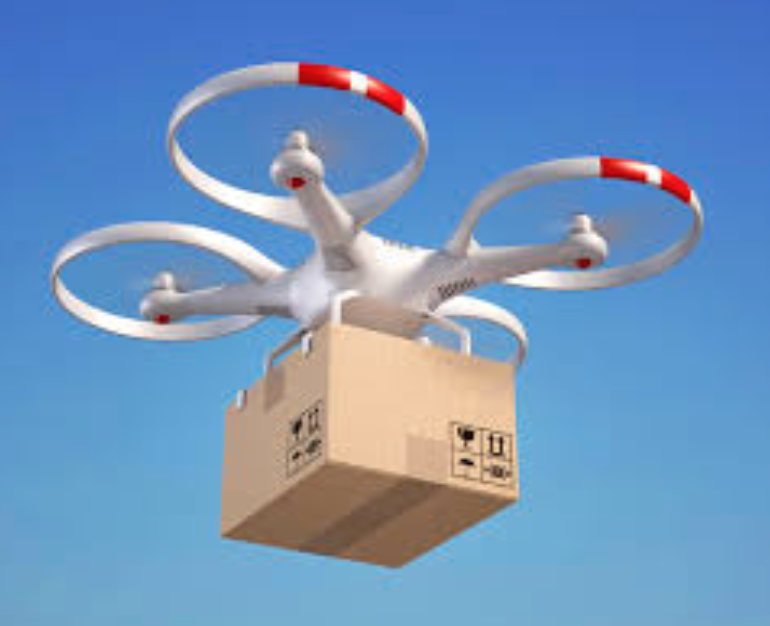
UAVs also offer the ability to access areas where the main infrastructure system has been severely damaged, preventing access into the site as well as the ability to communicate with people trapped there. Not only can drones provide a means of transporting supplies into disaster zones, with some now of enough size to transport large pieces of equipment and people in and out of the region – but they can also operate as a temporary communication network, allowing mobile transmission when local networks have been disrupted.
Permission to take off
One of the main issues which is serving to effectively ground drones in disaster-related situations is the difficulty of securing permission from the relevant aviation authorities to operate the vehicles in the airspace over the impacted area. One of the key advantages of such technology is the ability to deploy UAVs much more quickly than manned aerial vehicles, but this becomes valueless if the approval process to fly in disaster zones takes days or weeks.
According to Dr Robin Murphy, a director at the Center for Robot-Assisted Search and Rescue, such delays can have significant knock-on effects on the overall effectiveness of your disaster response efforts. Commenting following a recent panel discussion ‘The Robot Revolution’, she highlighted the logarithmic heuristic developed by Haas, Kates, and Bowden in 1977 which she stated posited that reducing the duration of each phase of disaster response reduces the duration of the next phase by a factor of 10. “Thus, reducing the initial response phase by just 1 day reduces the overall time through the three reconstruction phases to complete recovery by up to 1,000 days (or 3 years). Think of what that means in terms of lives saved, people not incurring additional health problems, and the resilience of the economy.”
According to Dr Adams, it is not surprising that regulatory restrictions are proving a limiting factor in the use of drones over affected sites, highlighting the fact that this was a challenge following the Tianjin explosion in China. “The civilian use of drones is a relatively new and evolving type of technology and as such there are inevitably going to be legislative aspects that will need to be considered. In some countries, it is already possible to gain permission to operate UAVs, but this can be a lengthy process which can mean that by the time approval is given there is no longer any need to use the drone.”
The American Red Cross report calls on the US Federal Aviation Administration (FAA) to re-evaluate its use of certificates of waiver or authorisation (COAs) which are issued to allow public entities to fly over restricted areas in cases of emergency. Such COAs are not, however, issued to private organisations.
The report calls for the FAA to “develop an emergency COA process for private sector and non-profit organisations that would allow for the on-demand operation of drones post disaster and issue blanket approval for locations which these entities can fly.” The report also calls for authorisation to be granted with 24 hours of a disaster being declared to facilitate a rapid response, and for permission to be given for flying over populated areas.
The FAA is taking steps to address some of these issues. Most recently, the body set up a new micro unmanned aircraft systems (UAS) aviation rulemaking committee to look at regulations to allow for unmanned aircraft to operate over people. The group only met for the first time in March 2020 and by April had already produced its initial findings, recommending that four UAS categories be set up based on potential risk to people, as well as addressing operational restrictions and standards to minimise risks. FAA administrator Michael Huerta said: “This type of collaborative government and industry partnership is exactly what is needed to keep pace with this rapidly changing industry and will serve as a model for future rulemaking advisory tasks.”
The sky is not the limit
It is inevitable that the role of drones in disaster-related environments will expand. There have been significant advances in the capabilities of such vehicles in recent years, both in terms of the aircraft itself and the range of sensory technologies that they carry. Yet, as is always the case with innovation, it will take time for both responders and regulators to get to grips with the potential that drones offer. Offering a safer, faster and in many cases more effective means of accessing devastated environments, as well as the ability to support recovery and resilience planning efforts, surely drones cannot remain in a holding pattern for much longer?
Drones are getting bigger and more powerful all the time, this one can carry over 56 pounds in weight, it is equipped with 360 degree cameras and I believe could slip under the radar on unsuspecting Dam’s, Power Stations, Airports or similar high risk plants, The new night vision Drones providing strange lights In the night’s sky are getting people’s attention, now equipped with super long endurance flight operation platform. New Heavy Payload, Hybrid Electric Drone complete with 30 X Optical Zoom Camera Long Flight Time · Intelligent Flight Modes, operators are required to obtain written permission to fly within certain limits.
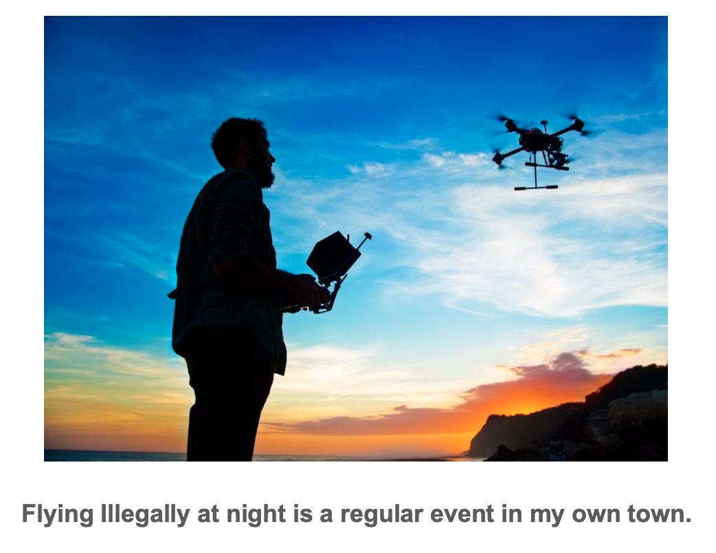
At night you are unlikely to be able to monitor the drone’s flight path without night vision in relation to other aircraft or persons, vehicles, vessels and structures for the purpose of avoiding collisions? Can you really do this safely? Commercial operators are required to submit a specific safety case in support of a request to fly at night.
While operators must always keep your drone away from aircraft, helicopters, airports and airfields. Recreational drone operators are strongly advised not to fly within 3 Miles of Commercial operators and are required to obtain specific permission from Air Traffic Control to fly within 3NM of an airport, in addition to holding a CAA Permission for their activities.
Advertised on the internet, JD.com, also called Jingdong, is China’s largest online retailer of drones, with a national distribution network matching the coverage of Amazon in the United States. It’ll soon have something its American counterparts doesn’t:
Super-sized delivery drones.
JD.com’s robots will be autonomous, three-engine, vertical-takeoff drones that can carry a payload of over 1 ton up to 186 miles. They’ll be the world’s largest delivery drone on the civilian side.
The U.S. military, of course, has the KAMAX, but no American commercial entity has anything close; Amazon is still wrestling with the FAA about where and when it can safely fly its parcel-carrying quadcopters. I’m sorry but this is the world we live in.
As research and technology increases there is no doubt that bigger and more powerful Drones will arrive and some will be used by either criminals or Terrorists.
BIO:
Dr Bill Pomfret; MSc; FIOSH; RSP. FRSH;
Founder & President.
Safety Projects International Inc, &
Dr. Bill Pomfret & Associates.
26 Drysdale Street, Kanata, Ontario.K2K 3L3.
www.spi5star.com pomfretb@spi5star.com
Tel 613-2549233